What is Synthetic Aperture Radar?
Synthetic Aperture Radar (SAR) is an incredibly powerful distant Earth observation tool used to create high-resolution images the Earth’s surface. Using a radar, SAR satellites scan and map the Earth’s surface, producing two-dimensional images or three-dimensional reconstructions of landscapes.
Synthetic Aperture Radar (SAR) is an incredibly powerful distant Earth observation tool. Using a radar, SAR satellites scan and map the Earth’s surface, producing high-quality two-dimensional images or three-dimensional reconstructions of landscapes.

How Does Synthetic Aperture Radar Work?
SAR is an active sensor, emitting pulses of microwave radiation down to Earth that are reflected back, or ‘backscattered’, off far-away objects. The instrument then measures the distance between its sensor and the target that reflected the pulse.
SAR can determine an object’s exact location, a target’s velocity as well as the distance between objects. It can also differentiate between moving and stationary objects.
Mounted on a satellite, the radar’s beam creates a ‘footprint’ on the ground as it scans – imagine this like a spotlight. Once the microwave pulses hit the ground, they’re reflected off different objects and scattered back in multiple directions. Some of these pulses will bounce back in the direction of the satellite to be recorded. You can compare this process to a bat using echolocation.
The radar now needs to differentiate these returned pulses to understand the specific objects or landscapes that reflected them. Distance is determined by measuring the time taken for the pulse to reach the ground and return back to the radar, using the equation ‘distance = time X velocity’. In this instance, velocity is the speed of light as we know the pulses travel at this speed.
Now, we need to get more specific to calculate the direction each pulse came from. As the radar’s beam scans the ground, it notes the pitch at which the echoes are reflected. As the footprint moves, the reflected echoes’ pitches directly relate to objects’ positions within the beam. An increasing pitch means that the ground is approaching the satellite, with a decreasing pitch showing the ground receding from it. Since we’ve already calculated their distance, each specific echo can now be located from a particular intersection of the radar’s footprint.
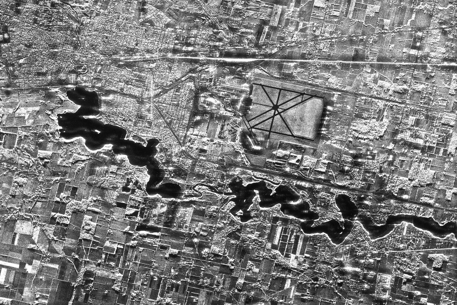
Finally, we need to calculate the size of the object reflecting the waves. Smaller objects will reflect a smaller echo, producing a dark pixel. Medium-sized objects will reflect a medium echo, producing a somewhat brighter pixel, with larger objects reflecting back an even brighter one. Water completely reflects the pulse, creating a black pixel.
All of these elements combined and working in harmony produce a radar image of the Earth’s surface.
What Are the Benefits of Synthetic Aperture Radar?

SAR has day, night and all-weather capabilities. It doesn’t require sunlight to function and is not affected by atmospheric conditions. It can also “see” through things like vegetation, snow, sand and smoke.
Able to collect data at different wavelengths, SAR can obtain many types of information such as water and moisture content, surface makeup, the impact of natural or man-made disasters and changes in habitat. The ability to repeatedly scan the same area regardless of weather conditions makes SAR a great tool for measuring changes in Earth’s landscapes and environment. These capabilities provide enormous value for industries such as geospatial intelligence that rely on environmental data and imaging to document and assess human activity on Earth.
What is Synthetic Aperture Radar Used For?
SAR technology provides immeasurable valuable across a long list of industries, as well as to the rest of mankind. It puts us one step ahead of the many adversaries facing our planet, allowing us to monitor, assess and remedy natural and man-made threats.
SAR has a wealth of environmental applications, such as monitoring climate change, natural disasters, ecosystem loss, pollution, forests, agriculture and offshore vessels.
- Agriculture – monitoring surface makeup, identifying crops, monitoring growth, creating yield prediction models
- Floods – creating flood prediction models, estimating flood depth, assessing flood damage
- Forests – detecting and monitoring deforestation, estimating biomass and forest height
- Subsidence – monitoring land subsidence, warning of potential infrastructure collapse or instability
- Snow and ice monitoring – detecting and monitoring ice depletion, identifying glacier motion, monitoring water levels
- Wildfires – penetrating smoke to monitor and assess severity and loss of forest fires
- Offshore vessels – detecting and monitoring oil spills as well as vessel movement
SAR is also a key component of defence and security. Modern camouflage, concealment and decoy strategies are used to disguise and disrupt the appearance of military targets. As these stealth tactics develop, the nature of the threat to defence is advancing alongside technology. The clear images obtained by SAR satellites in practically any atmospheric condition allow us to develop counter-stealth solutions, maintaining a strategic edge over the opposition.
What’s the Difference Between Traditional Satellites and SAR Satellites?
Traditional optical satellites use light reflected from the sun, collecting the reflected energy off the Earth’s surface much like a camera or a human eye. When collecting images, these satellites see the world in the same way we do, clouds, weather and all.
SAR satellites, on the other hand, are active sensors that produce their own energy source. This gives them higher capabilities in a range of conditions and allows them to capture such high-quality images. As an active monitoring tool, SAR can also cover greater areas than optical satellites in much less time.
 Radar allows us to see through clouds, rain, trees and in the dark thanks to the long wavelength of radio waves, in comparison to the shorter light waves used by traditional satellites. These radio waves are emitted through an antenna, or aperture, with the radar image’s resolution depending on the size of the antenna to the size of the wavelength. This means that for radio waves, a larger antenna is needed to create the same high-resolution images. This creates challenges if you want to launch your radar on a satellite to image large distant areas at a time. That’s where SAR satellites come in.
SAR satellites produce high-resolution images of large areas by moving a small aperture over long distances. This allows us to combe several viewpoints into one radar image, thus creating a large synthetic aperture.
When scanning, the Antarctic for example, a SAR satellite would be able to pick up extremely detailed surface textures, allowing us to deduce the ice’s thickness. Optical satellites would not be able to detect this level of detail and would portray a simpler image of the surface snow and ice.
Working with Synthetic Aperture Radar (SAR)
- SAR systems engineer: responsible for the design, development, and testing of SAR systems
- Satellite controls engineer: responsible for the design and operation of the control systems used to point and steer satellites equipped with SAR systems
- Electrical engineer: responsible for the design and development of electronic components used in SAR systems, such as antennas, receivers, and processors
- Data scientist: responsible for analyzing and interpreting data collected by SAR systems to generate insights and inform decision making
- System architect: responsible for the overall design and architecture of SAR systems, including defining system requirements, specifying system components, and ensuring compatibility among components
- Remote sensing specialist: responsible for the interpretation and analysis of data collected by SAR systems to support various applications, such as mapping, environmental monitoring, and disaster response.
SAR Salary Guidelines
- SAR systems engineer – $138,022
- Satellite controls engineer – $97,500
- Electrical engineer – 104,439
- Data scientist – $121,165
- System architect – $154,798
- Remote sensing specialist – $135,000
SAR Geographic Hotspots
- Washington DC-Baltimore
- San Francisco Bay
- Los Angeles
- Boston
- New York
Whichever path you take, a career in SAR is as rewarding as it is exciting. It provides individuals with the opportunity to work on cutting-edge technology, while making a real difference in the world. With the ever-growing demand for SAR technology, the space sector is ripe with incredible opportunities for those interested in this field.