Satellite Forecasting:
Revolutionizing Weather Prediction and Beyond
As we strive to understand and adapt to the continually changing climate patterns, satellite forecasting technology has become a cornerstone in our approach to weather prediction and management. The increasing global reliance on accurate, real-time weather data has necessitated remarkable advancements in satellite technology and climate science. Today, satellite forecasting is revolutionizing weather prediction and significantly influencing various sectors, including disaster management, agriculture, aviation, and shipping, among others.
Satellite Forecasting: A Transformative Leap in Weather Prediction
Satellite forecasting, a modern marvel of climate science, has dramatically changed the meteorological landscape. Advanced imaging satellites, such as geostationary satellites and polar-orbiting satellites, tirelessly monitor the Earth’s atmosphere, oceans, and land surfaces. This capability provides meteorologists with a global perspective on weather patterns, ensuring the creation of more accurate and timely weather forecasts.
The Intricate Process of Satellite Forecasting
The process of satellite forecasting is multi-faceted, beginning with the acquisition of data. These space-based observers capture images, measure radiation levels, and detect variations in the electromagnetic spectrum. Once transmitted to ground stations, this data is processed and converted into valuable weather-related information.
This information undergoes thorough analysis and integration with other meteorological datasets, such as data from ground-based weather stations, weather buoys, and drones. Advanced algorithms and computer models interpret the information, identifying weather patterns, storm systems, and atmospheric conditions. Utilizing a blend of historical data, atmospheric physics, and mathematical equations, these models simulate and predict the future state of the atmosphere, leading to more reliable forecasts.
Applications of Satellite Forecasting
Disaster Management:
 Satellite forecasting plays a pivotal role in disaster management by providing early warnings, mapping vulnerable areas, and supporting post-disaster relief and recovery. The real-time, accurate data facilitated by advanced satellite forecasting and geo-intelligence helps in informed decision-making, reduces disaster risk, and enhances resilience. Find out more here.
Precision Agriculture:
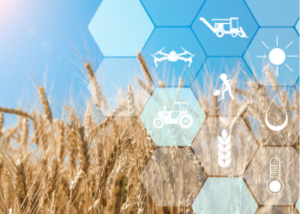 Satellite technology is transforming agriculture by leveraging remote sensing and the Global Navigation Satellite System (GNSS) for crop health monitoring, soil condition assessment, and irrigation optimization. Accurate weather predictions enable farmers to make informed decisions about planting, fertilization, pest management, and harvesting, thus promoting sustainable agriculture.
Climate Studies:
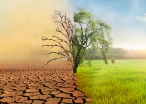 Satellites provide invaluable data for understanding long-term climate trends. By monitoring variables such as temperature variations, sea ice extent, ocean currents, and greenhouse gas concentrations, scientists can analyze climate patterns and make predictions about future climate change. This information is crucial in shaping sustainable policies and strategies to mitigate the impact of climate change.
Aviation and Maritime Operations:
 Accurate weather forecasts are essential for the safety and efficiency of aviation and maritime operations. Satellite data provides real-time information on cloud cover, turbulence, wind patterns, and sea conditions. This information allows pilots, ship captains, and navigation systems to plan routes, optimize fuel consumption, and circumnavigate hazardous weather conditions.
The Future of Satellite Forecasting
Satellite forecasting technology is set to evolve further, thanks to the advent of small, cost-effective CubeSats and advancements in high-speed data processing and AI. These developments promise to enhance the accuracy and utility of weather prediction. Moreover, the potential of this technology stretches beyond weather prediction to include environmental monitoring, climate change research, and space weather prediction, thus paving the way for a safer and more predictable future.
The integration of satellite data with other data sources such as ground-based weather stations, weather buoys, and drones will further enhance forecast accuracy and coverage. Additionally, progress in machine learning and artificial intelligence will streamline data analysis and model development, resulting in improved forecasts and faster processing times.
Satellite forecasting technology is revolutionizing weather prediction and impacting various sectors profoundly. By harnessing the power of satellites, meteorologists can observe the Earth’s atmosphere, oceans, and land surfaces in real-time, leading to more accurate and timely weather predictions.
This technology is also vital for understanding long-term climate trends, enhancing disaster management, transforming agricultural practices, and ensuring the safety and efficiency of aviation and maritime operations.
As we continue to explore and develop this technology, its potential to revolutionize not just meteorology, but a wide range of industries and scientific research areas, becomes increasingly evident. The next frontier in satellite forecasting promises profound advancements in our understanding and interaction with our planet and beyond.