NUVIEW to Revolutionize Earth Observation with Yearly 3D LiDAR Satellite Mapping
Embarking on an industry-defining mission, NUVIEW stands at the frontier of the Earth observation industry.
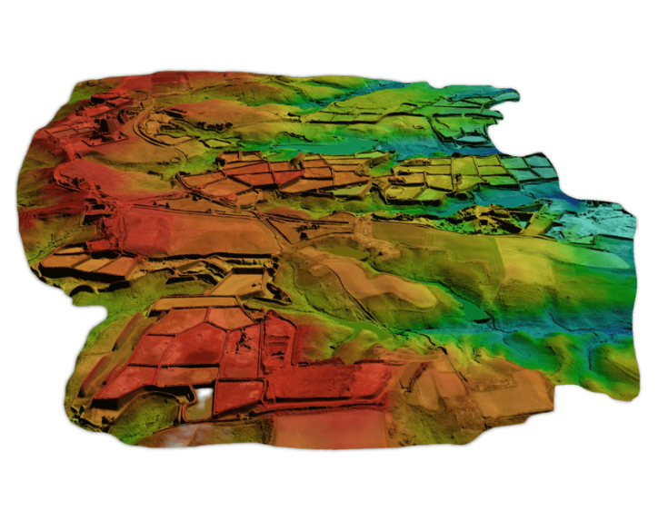
Their pioneering project is the first of its kind, setting the stage for a new epoch in global terrain mapping. By creating the first-ever commercial satellites equipped with Light Detection and Ranging (LiDAR) technology, NUVIEW is venturing into an uncharted territory that has been eagerly awaited for decades.
As we stand today, organizations shell out nearly $3BN every year to secure LiDAR data. Unfortunately, the yield from such substantial investment is merely a 5% mapping of the world’s surface, a limitation primarily due to the restrained capabilities of traditional airborne data collection methods. NUVIEW is set to disrupt this bottleneck with a more scalable, high-quality solution, democratizing LiDAR data access.
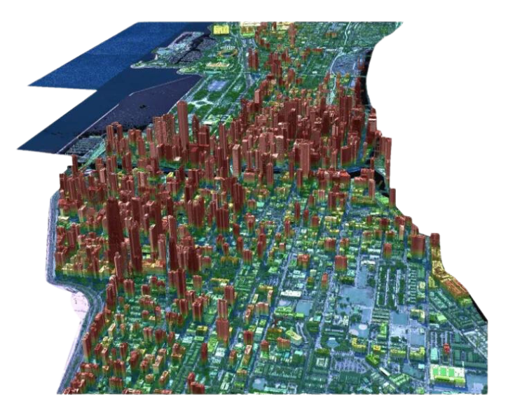
By leveraging cutting-edge satellite technology, NUVIEW is poised to revolutionize remote sensing. Their LiDAR imaging satellites will emit rapid-fire laser pulses, each meticulously measured for the time taken to reflect back from the Earth’s surface. By harnessing this data, NUVIEW’s satellites will construct intricate 3D maps of the terrain below, radically augmenting our understanding of the Earth.
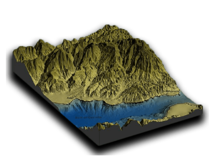
The current LiDAR mapping landscape offers a limited scope, with drones and UAVs covering only a handful of square kilometers each day, and aircraft barely managing hundreds. In contrast, NUVIEW’s satellite constellation aspires to capture millions of square kilometers, making the concept of comprehensive global LiDAR mapping a tangible reality.
The game-changing potential of NUVIEW’s initiative spans numerous applications across multiple industries. From evaluating the density of vegetation in tree canopies for carbon production, to devising efficient water management strategies for farmers, the possibilities are immense. The regular updates from NUVIEW’s satellites also enable large-scale applications in flood mapping, forestry assessment, and infrastructure planning, all of which were previously impractical.
While this is undoubtedly a monumental technological challenge, NUVIEW’s team is prepared and equipped to tackle any technical hurdles. They stand ready to pioneer a future where the annual comprehensive mapping of the Earth’s land surface is a norm rather than an exception.
As NUVIEW blazes this trail, the company is recruiting across various roles and disciplines, inviting professionals to join this unique opportunity to be a part of a revolutionary endeavor that promises to redefine the remote sensing industry. EVONA is dedicated to helping guide you through this transition, ensuring a seamless move to NUVIEW. Embrace this extraordinary chance to contribute to a game-changing mission in Earth observation, supported every step of the way by our crew of experts.
“Joining NUVIEW is more than just being a part of a groundbreaking team. It represents a unique opportunity that is truly extraordinary,” commented Katie Graumann, NUVIEW COO and co-founder. “As members of this pioneering team, we are at the heart of a revolution, pushing the boundaries of what the remote sensing industry is capable of. We are not just observers of change, but makers of it, blurring the lines between what was once imagined and what is now achievable. NUVIEW is more than just a company — It is a lighthouse of innovation, illuminating the path to untapped possibilities and pioneering solutions in Earth observation.”
In their ambition to image the Earth’s entire land surface annually, NUVIEW is setting out to establish a new gold standard in global elevation data. This landmark mission is more than a scientific breakthrough; it’s a game-changer that fundamentally enhances our perception of the planet we inhabit.
Contact our crew and join NUVIEW in making this seismic shift a reality.
-
India Successfully Lands Spacecraft on Moon’s South Pole
India achieves a historic milestone by successfully landing Chandrayaan-3 spacecraft on the moon's south pole, marking the nation's ascent to lunar exploration. Learn about the significance of this achievement and its implications for space exploration.Read More -
Timber in Orbit: Japan’s Wooden Satellite Prepares for Launch
In a groundbreaking endeavor, Japanese researchers are challenging conventions by showcasing the unexpected resilience of wood in the hostile environment of outer space. This extraordinary feat raises an intriguing question: could wooden satellites hold the key to a sustainable future for space technology?Read More -
Seradata Welcomes Melissa Quinn: New Horizons with EVONA
Breaking: Melissa Quinn's new role unveiled - placed by EVONA. Discover her transformative journey from Spaceport Cornwall to Seradata.Read More